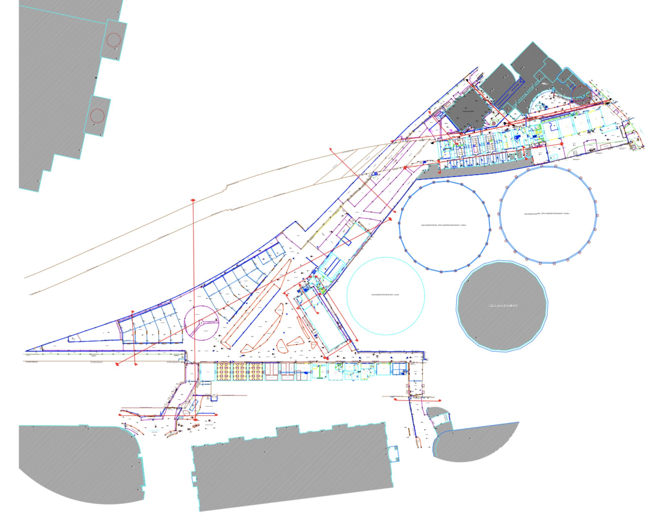
Topographical Surveys
Above ground mapping determining man made and natural features on land, including trees, walls, buildings, fences, services, paths, roads, and neighboring buildings using the latest Leica Total Station and GPS equipment.
Site Mapping
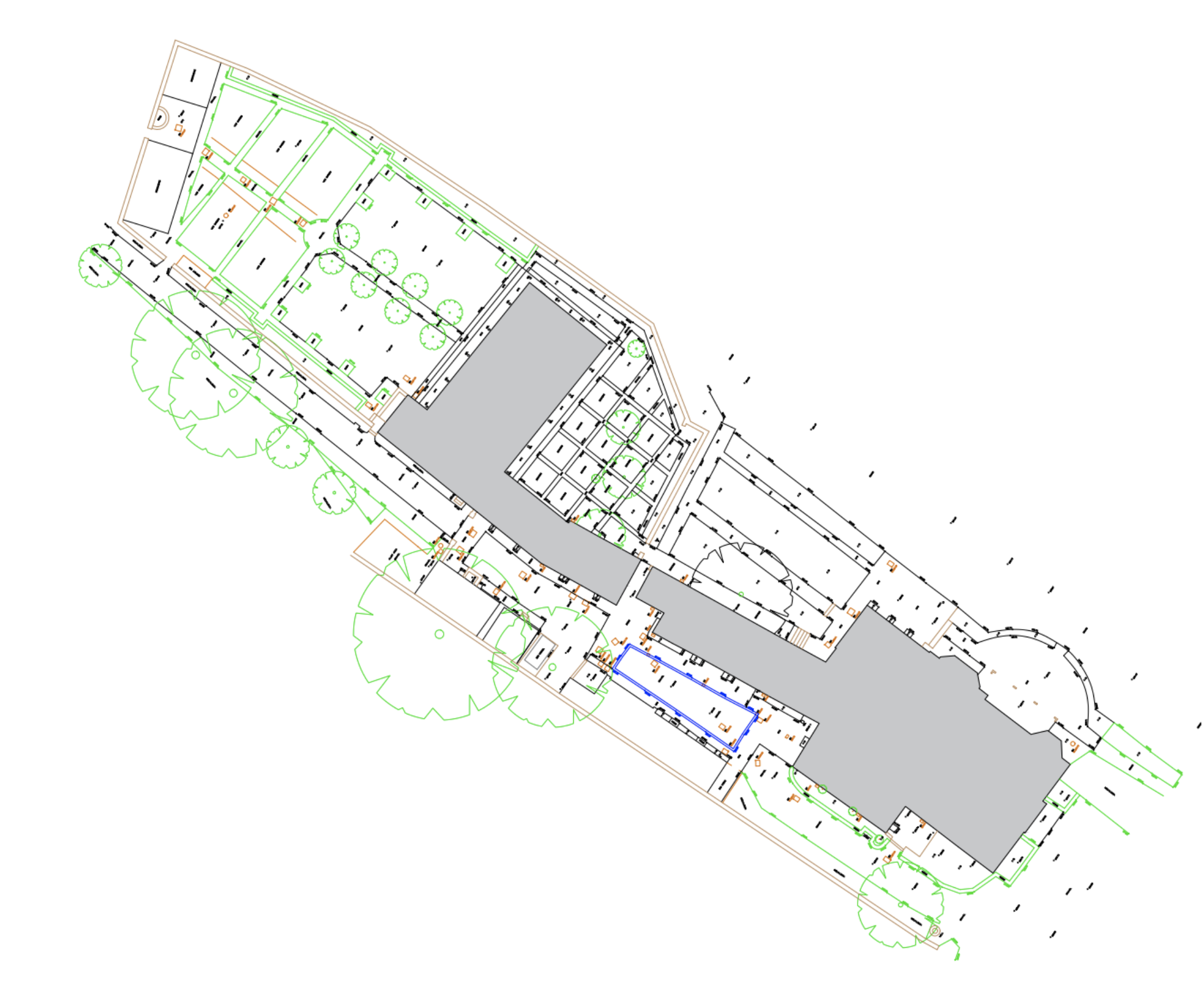
Above ground mapping determining man made and natural features on land, including trees, walls, buildings, fences, services, paths, roads, and neighboring buildings. Our detailed surveys provide a complete picture of your site.
Using the latest Leica Total Station and GPS equipment, we capture every relevant feature with precision accuracy for your planning and design needs.
Get in Touch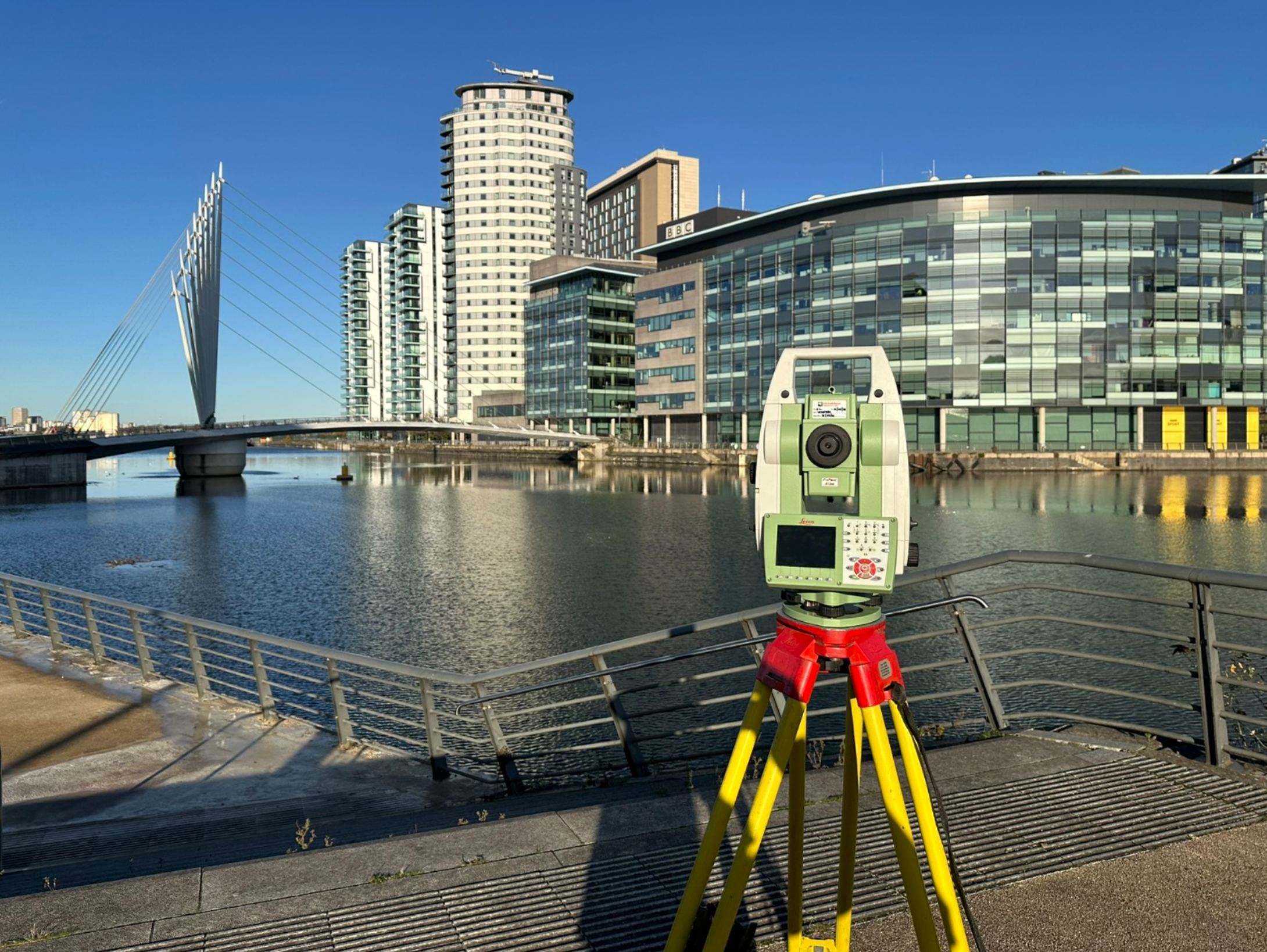
Built & Natural Features
Documentation of buildings, walls, fences, utilities, and all man-made structures on site. We also identify and map trees, vegetation, watercourses, and landscape elements that may affect your development plans.
Tree surveys can include species identification, trunk diameters, canopy spreads, and root protection areas for planning compliance.
Get in TouchBoundary Definition
Precise boundary measurements for land registry, disputes, and legal documentation. We can identify physical boundary features and provide accurate coordinates for cadastral purposes.
Our surveys integrate GPS positioning with traditional surveying methods to ensure your boundary data meets the highest standards of accuracy and legal compliance.
Get in Touch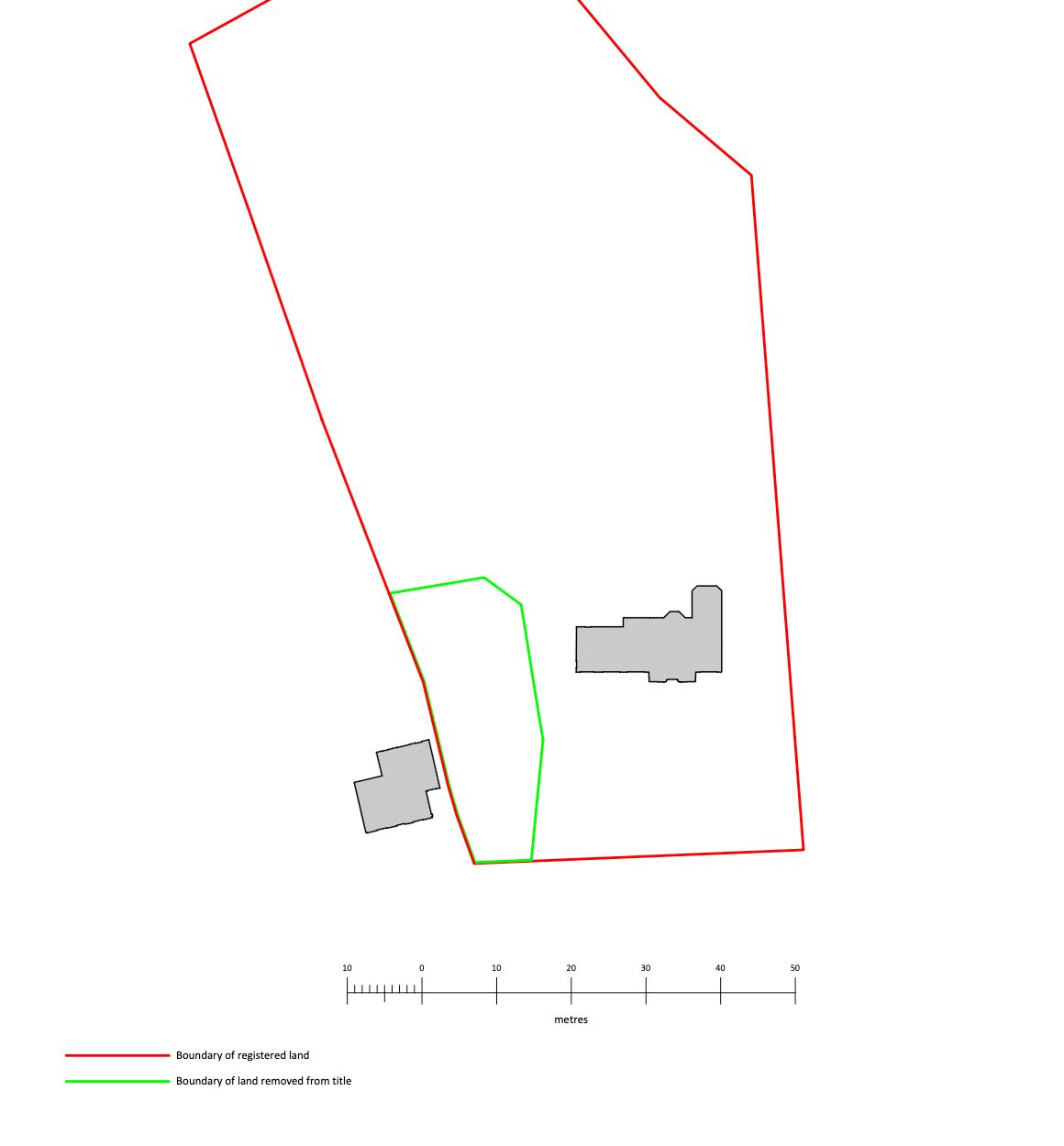
Client Testimonials
See what our clients say about working with us
"We've worked with Scott for many years and know that we can always depend on him to deliver detailed, accurate, high-quality results. This is important to our business and also very beneficial to our clients, as high-standard precision is essential for the basis of architectural proposals – particularly for complex requirements such as planning applications within conservation areas. Scott is also a good communicator and a pleasure to work with."
"We have used Collins Architectural Surveys for at least six years, they are our go-to firm for measured surveys. They work hard to understand our requirements, often going above and beyond to deliver excellent surveys within tight deadlines."
"We regularly require measured surveys at the outset of our projects. For over five years our preferred surveying company has been Collins Architectural Surveys. We have found them to be professional and responsive, and they have coped with a wide variety of project and building types without issue."
"Precision, detail and accuracy is everything my company stands for, and none of this would have been possible without Scott's involvement."
"Collins Architectural Surveys are fast and efficient. They always provide a high level of service and quality in each and every project."
← Drag to see more testimonials →
"All site scans are personally carried out by me to ensure the highest level of accuracy and detail."
Ready to Start Your Project?
Contact us today for a free consultation and quote for your topographical survey requirements.