Professional Survey Services
Cutting-edge 3D laser scanning and surveying solutions for London and Manchester
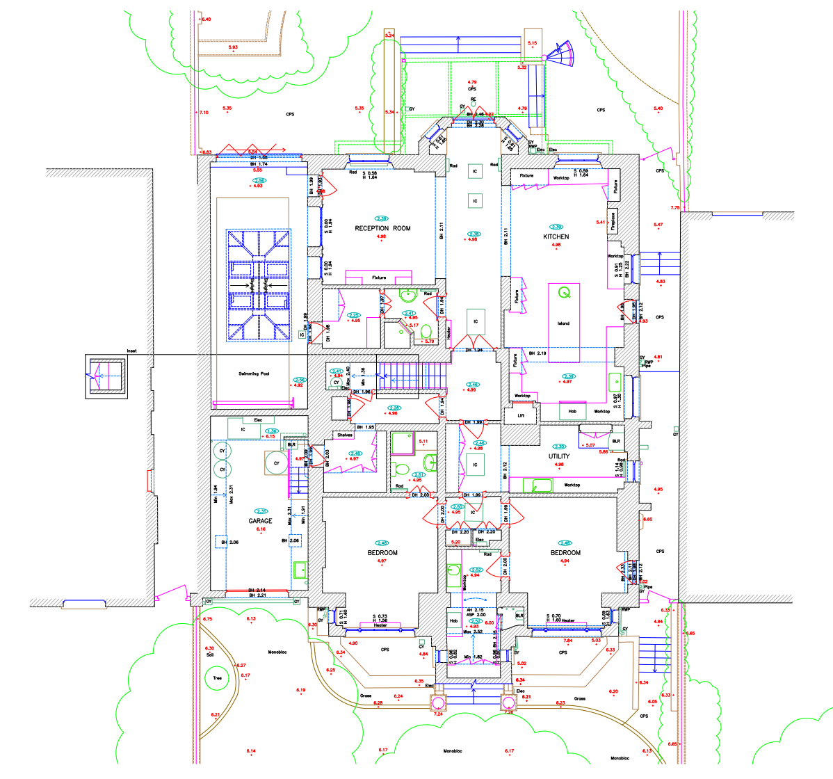
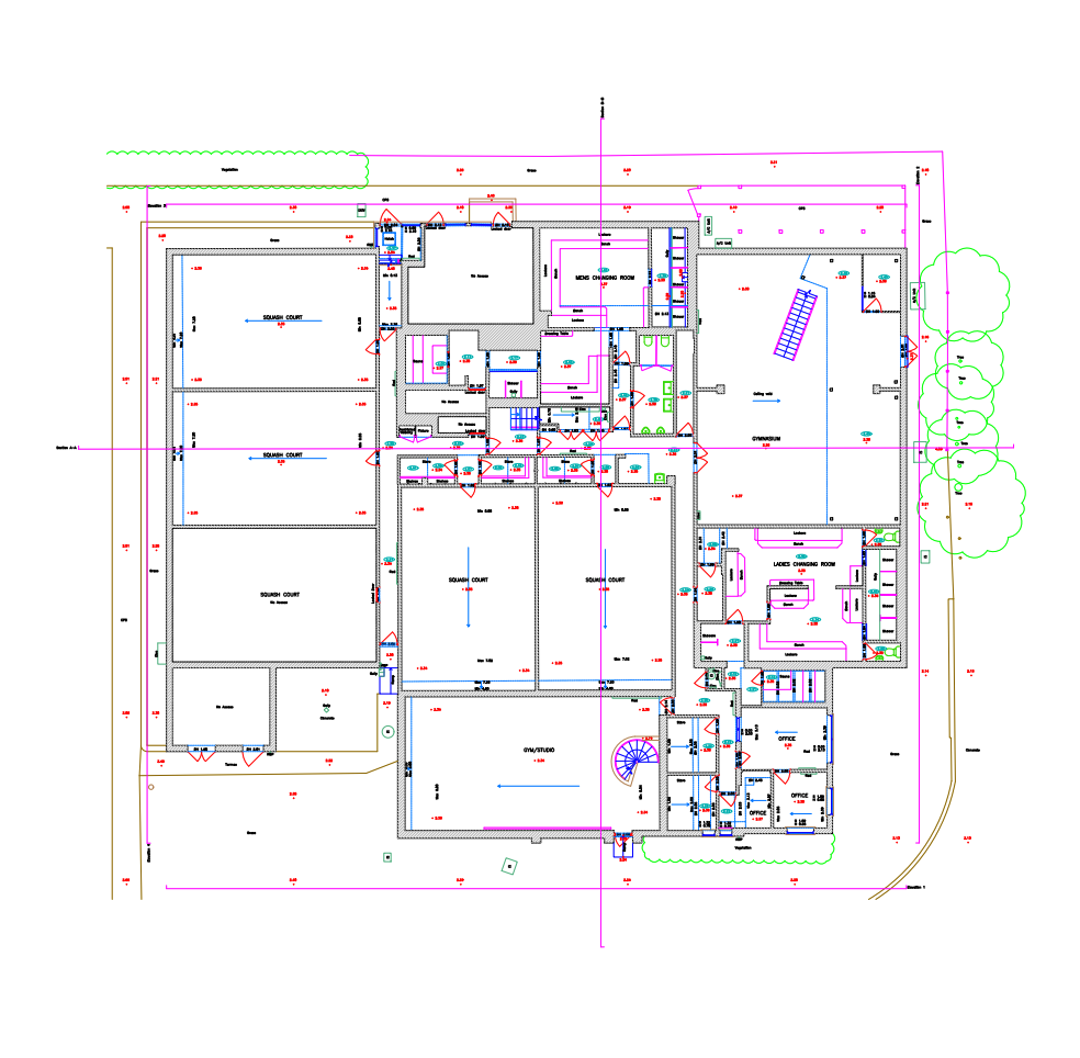
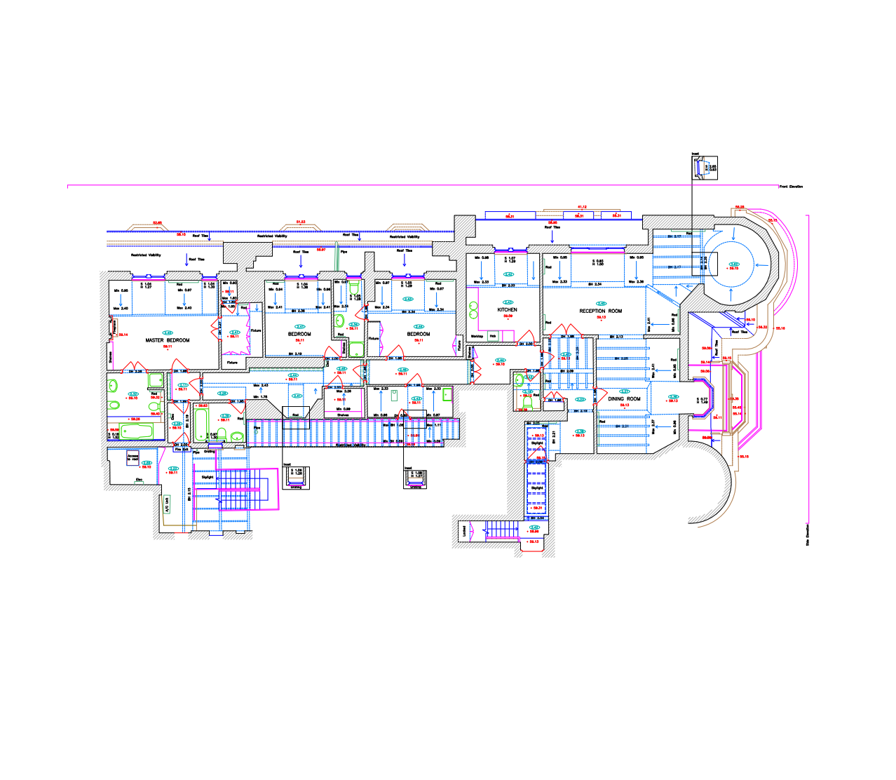
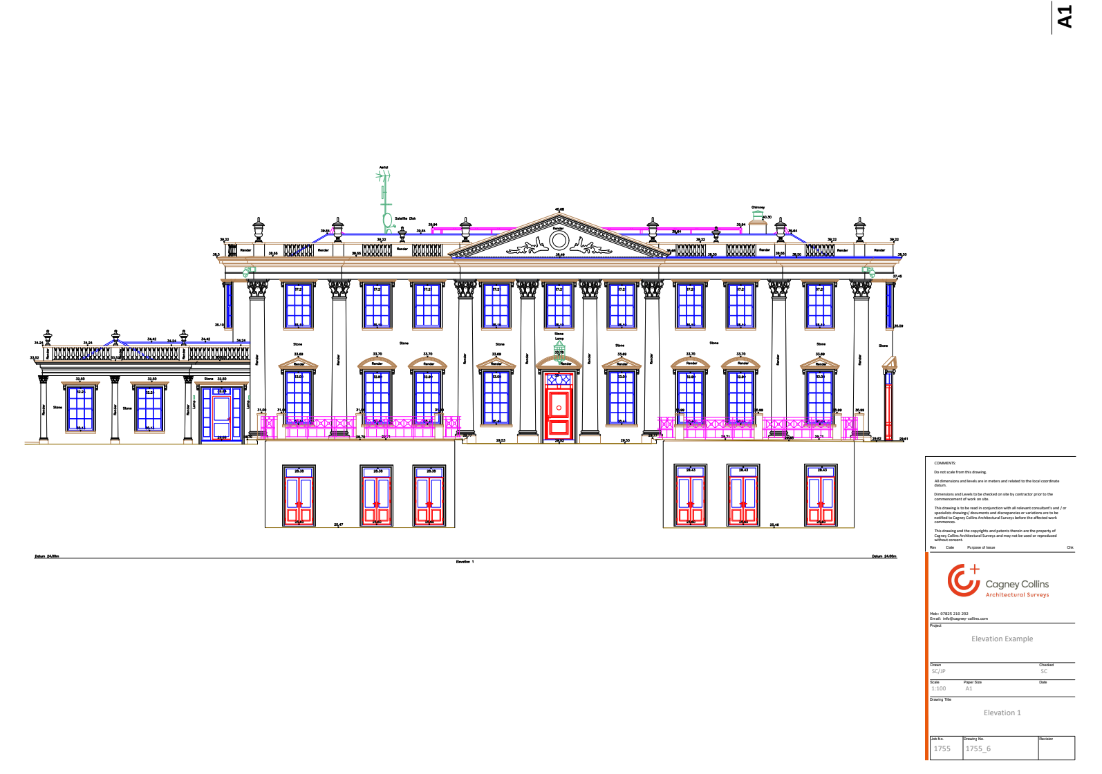
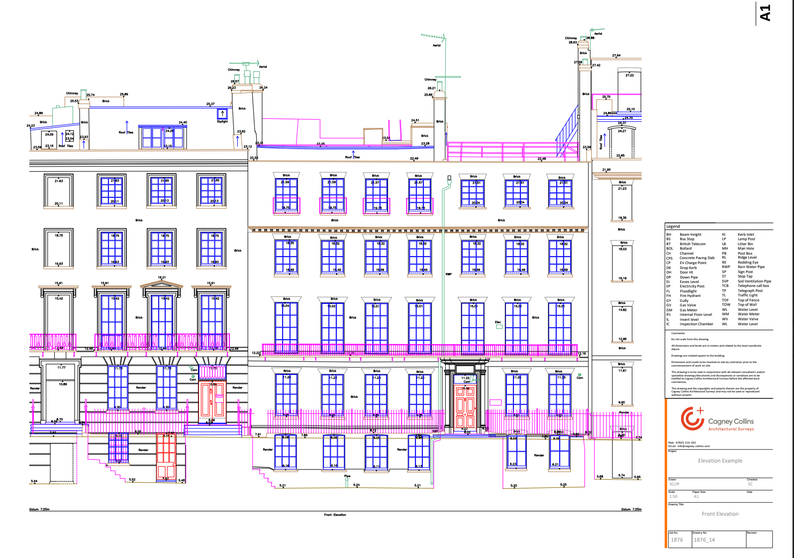
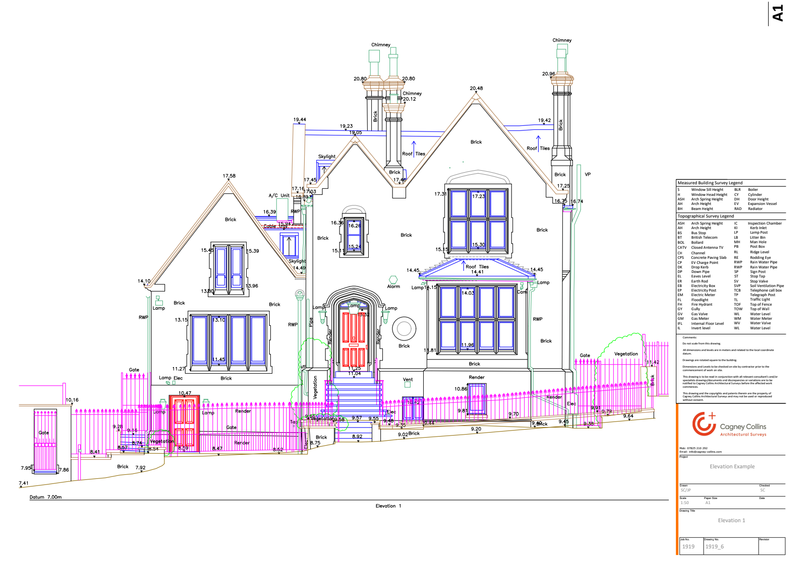
Measured Building Surveys
Comprehensive building measurements using advanced 3D laser scanning technology for accurate architectural drawings.
- Floor plans
- Elevations
- Sections
- 3D models
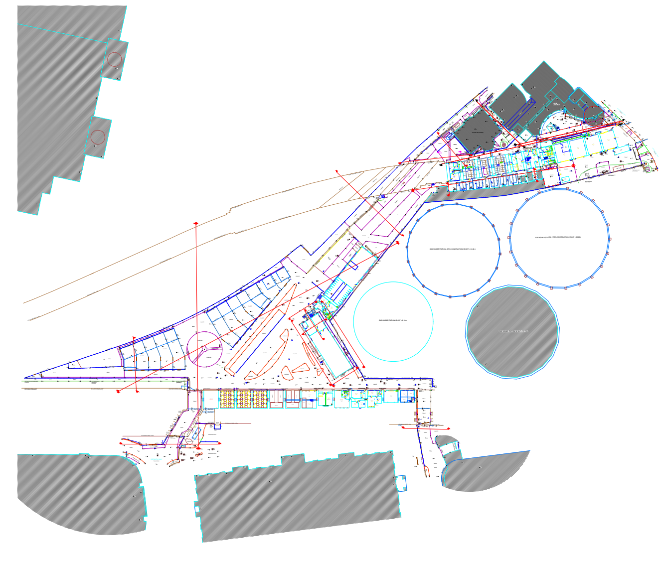
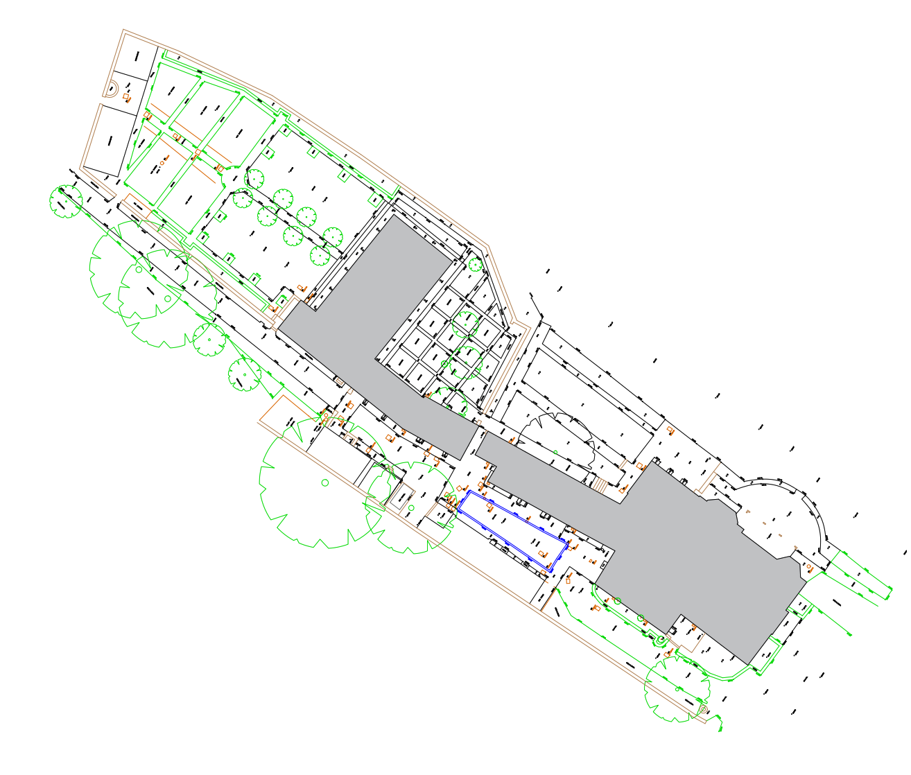
Topographical Surveys
Detailed land surveys capturing terrain features, boundaries, and existing structures for development projects.
- Contour mapping
- Boundary surveys
- Utility mapping
- Site analysis
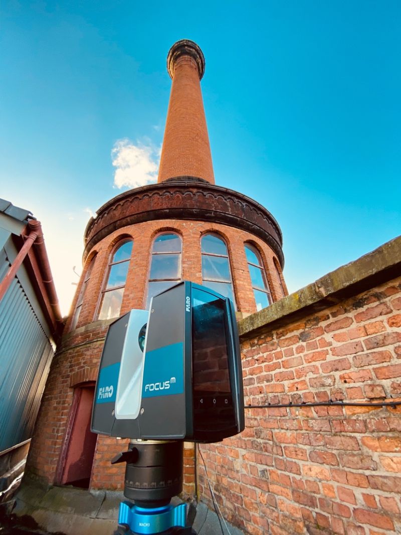
3D Laser Scanning
High-precision point cloud data capture for complex structures and heritage buildings.
- Point cloud data
- Millimeter accuracy
- Fast data capture
- Digital preservation
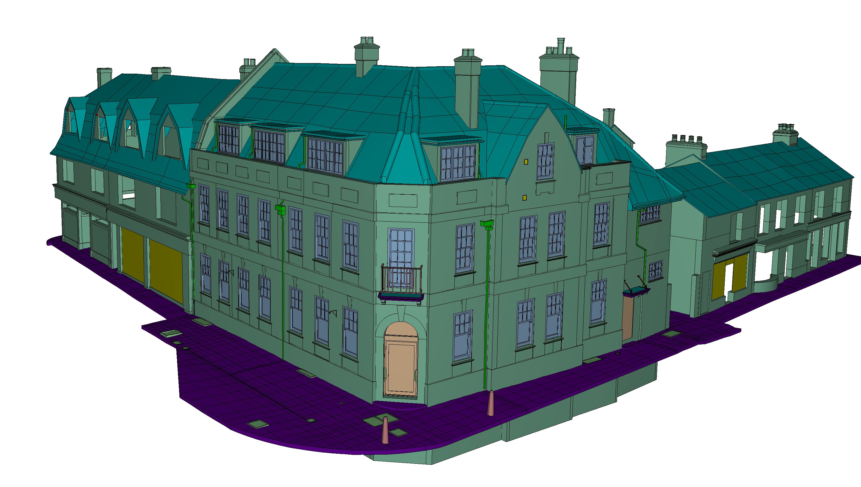
3D Modelling
Convert point cloud data into detailed 3D models for CAD, BIM, and visualisation platforms.
- 3D modeling
- CAD/BIM export
- Accurate geometry
- Multi-platform support
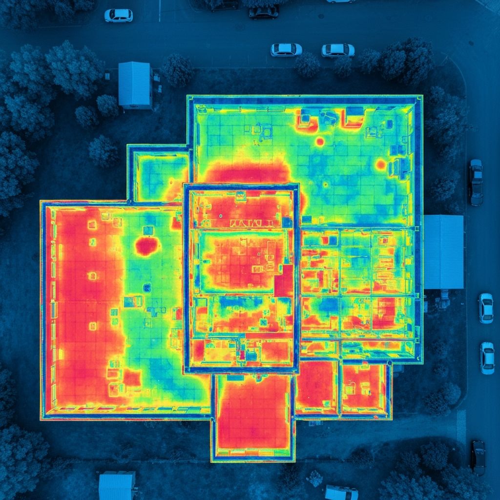
Thermal Drone Surveys
Advanced aerial thermal imaging technology for comprehensive building diagnostics and energy efficiency assessments.
- Thermal imaging
- Heat loss detection
- Solar panel inspections
- Energy efficiency analysis
"All site scans are personally carried out by me to ensure the highest level of accuracy and detail."
Ready to Start Your Project?
Get a free consultation and quote for your surveying needs